Planning a journey to Peru requires a balance of logistical foresight and a realistic understanding of the country’s geography. While the allure of ancient ruins is strong, the physical distance between major hubs can complicate an itinerary if you do not choose your transit methods wisely. This guide focuses on the practicalities of moving across the Peruvian landscape to help you maximize your time on the ground.
Choosing Your Entry Point and Flight Logistics
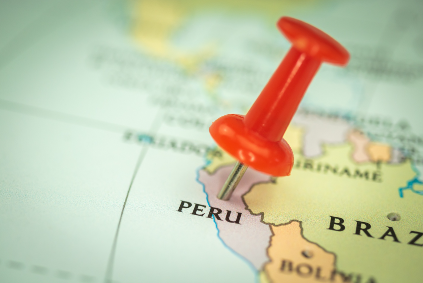
Most international travelers arrive via Jorge Chávez International Airport in Lima. Because Peru is a large country with a rugged spine formed by the Andes, flying is often the only practical way to traverse long distances quickly. If you plan to visit the southern highlands, you will likely book a domestic flight from Lima to Cusco.
When booking these internal hops, look for reputable carriers that maintain high safety standards and reliable schedules. The weather in the mountains can be unpredictable, often leading to delays or cancellations in the afternoons. Booking morning flights usually mitigates this risk. Keep your personal identification cards in an easily accessible pocket of your carry-on, as security checkpoints for domestic travel are frequent and strict.
Navigating the Sacred Valley and Cusco Region
Once you reach the highlands, your focus shifts to the Sacred Valley. This region serves as a lower-altitude staging ground for those preparing to see the Machu Picchu citadel. Many visitors find it helpful to head straight from the Cusco airport to the valley to acclimate.
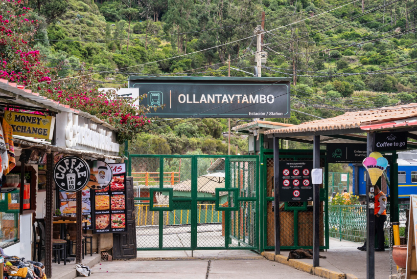
Transportation within this area varies by budget and comfort level. You can hire a private vehicle through your hotel or a local agency, which allows you to stop at markets and ruins at your own pace. If you are heading toward the train station, you will likely pass through Ollantaytambo Peru, a town that remains a living example of Inca urban planning with its original stone streets and water channels. From here, most travelers board the train to Aguas Calientes, the small town sitting at the base of the mountain below the ruins.
For those seeking a more rugged approach, the Inca Trail offers a multi-day trek that culminates at the Sun Gate. Regardless of how you arrive, ensure your tickets are purchased months in advance, as the government limits daily visitors to this UNESCO World Heritage Site.
Exploring the High Altitudes of the South
If your itinerary extends beyond the Cusco area, you might consider traveling toward Puno to see Lake Titicaca. This journey involves a significant gain in elevation. You can choose between a long-distance bus or a luxury train that runs between Cusco and Puno. The train offers a slower, more scenic experience, while the bus is a functional choice for those on a tighter schedule.
Further south lies Arequipa and the Colca Canyon. This area is famous for its deep ravines and Andean condors. To get there from Puno or Cusco, many past travelers recommend using ‘hop-on, hop-off’ bus services designed for foreigners. These services provide a middle ground between the chaos of local buses and the high cost of private tours. They often include stops at viewpoints where you can capture photos from the high Andean plateaus.
Road Travel and Safety Considerations
While a rental agency might offer you a car in Lima or Cusco, self-driving is generally discouraged for first-time visitors. The terrain is exceptionally steep, and road conditions in rural areas can deteriorate rapidly during the rainy season. Furthermore, navigating local traffic patterns requires an aggressive driving style that is stressful for outsiders.
Using public transportation like the ‘colectivo’ (shared van) is the most common way locals move between nearby towns. These are inexpensive but can be crowded and lack modern safety features. If you are stopped at a checkpoint, the local police will ask for your passport or a high-quality photocopy. It is also wise to keep a cellular phone with a local SIM card, as GPS is vital for tracking your location, even if you aren’t the one driving.
Venturing into the Amazon and Beyond
Peru is not just mountains; a vast portion of its territory is covered by the Amazon Rainforest. Accessing the jungle typically requires a flight to Iquitos or Puerto Maldonado, as roads are nonexistent in the deep interior. Once you land, travel shifts from wheels to water. Motorized canoes are the primary vessels for reaching remote lodges.
If you are interested in diverse landscapes, you might also look into Rainbow Mountain. This has become a popular day trip from Cusco, but it requires a strenuous hike at very high altitudes. Similarly, the tourism sector has expanded around the coastal regions, where you can see the Paracas National Reserve or the Nazca Lines. Each of these regions requires a different set of gear, from humidity-wicking clothes for the jungle to heavy wool for the mountains. While exploring, you will likely encounter Andean weaving traditions, which are deeply integrated into the local culture and provide insight into the history of each specific valley.
Conclusion
Successfully navigating Peru depends on your ability to choose the right transport for each specific terrain. While the infrastructure is constantly improving, the geography remains a challenge. By prioritizing flights for long distances and relying on reputable bus or train services for regional travel, you can focus on the scenery rather than the stress of the road. Prepare your documents, stay aware of your surroundings, and allow for a little flexibility in your schedule to account for the unexpected nature of mountain travel.