Why Hikers Are Turning to Digital Maps
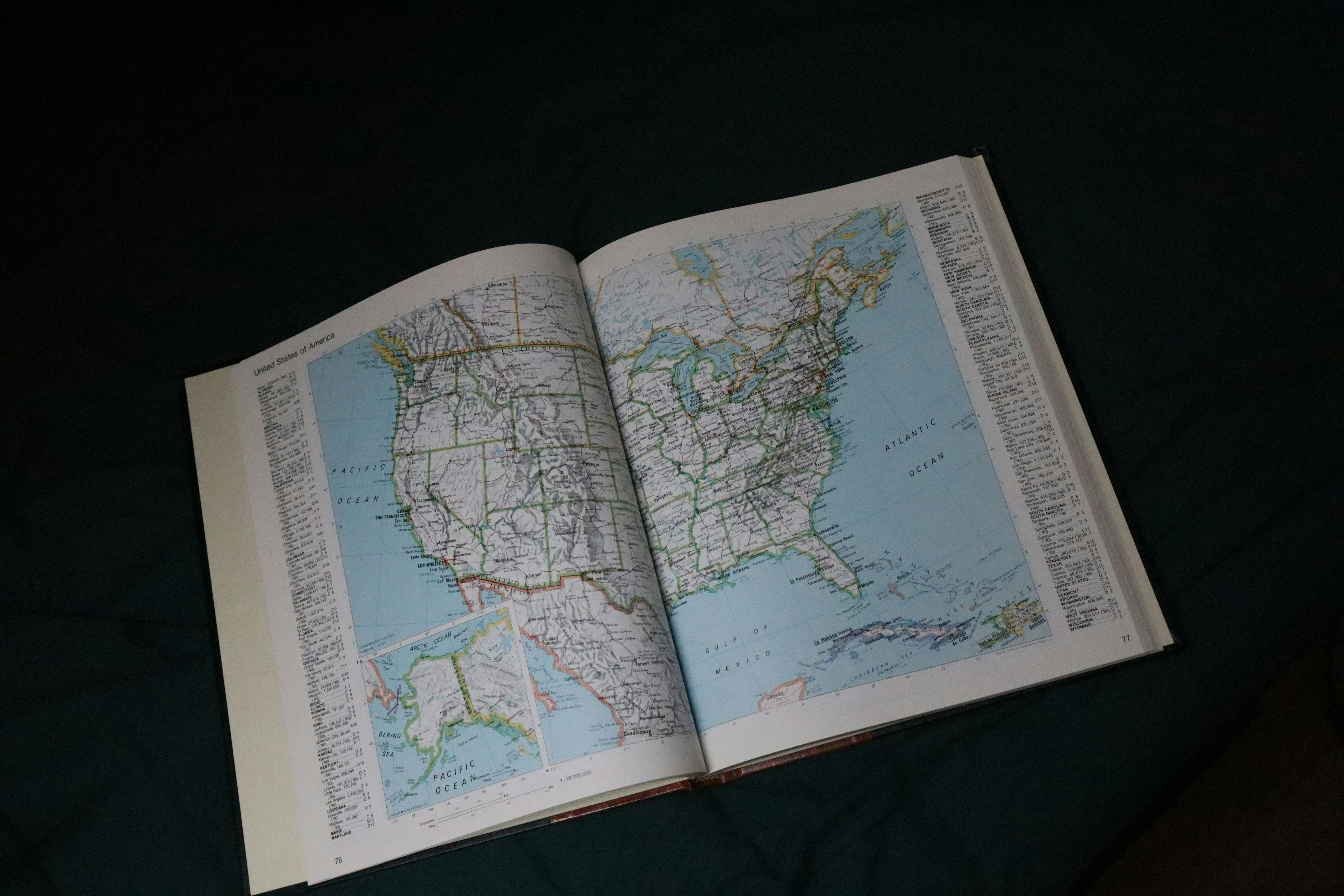
Trail books had their time. But by the time they’re printed, half their info is out of date trails get rerouted, storms wipe out sections, and conditions change faster than publishers can keep up. If you’re relying on a paperback from three years ago, you’re basically hiking blind.
Digital maps fix that. They update in real time. You get current weather data, active trail closures, fresh elevation profiles the kind of details that matter when you’re halfway up a ridgeline and trying to decide if you push through or pivot back.
Even better, you’re not alone anymore. These platforms pull in community added notes, photos, and real hiker intel. Tips about loose scree on the north face, spots with weak water sources, shortcut connections others have scouted stuff no guidebook ever had room for. It’s hiking for the now, shaped by people actually out there.
Features That Help You Find the Right Trail
Not all hiking paths are created equal, and digital map tools finally treat them that way. You can now filter trails by difficulty, terrain type, elevation gain, and distance all without flipping through outdated guidebooks. Whether you’re after a technical summit, a beginner friendly stroll, or a gravel packed trail runner’s dream, the right filters save time and eliminate guesswork.
Heading into remote zones? Offline maps are your lifeline. Modern apps let you download detailed area maps in advance, including topography, GPS coordinates, and user submitted updates. It’s peace of mind when reception disappears and you’re 10 miles from nowhere.
Route planning has also gotten smarter. Drop waypoints, map rest stops, flag water sources everything is drag and drop simple. It’s not just about where the trail leads anymore. It’s how you plan to move through it, mile by mile.
Popular Trails Discovered via Smart Mapping
Hidden gem hikes aren’t hiding anymore not for those using the right digital tools. Near almost any major city, you’ll find under the radar loop trails that dodge weekend crowds. These aren’t listed on tourist blogs or road signs. You’ll catch them by filtering for less reviewed paths or checking heatmaps on platforms like AllTrails or Gaia GPS. The loops are real: quiet, scenic, and usually within a short drive of the sprawl.
Want solitude and altitude? Digital maps are also pointing hikers toward lesser known alpine routes that don’t draw the usual foot traffic. With elevation layers and remote access info, it’s easier to plan around difficulty and remoteness finding serious climbs without human backup vocals echoing behind you.
Then there are coastal and desert routes tucked behind more popular landmarks. Terrain layering shows where ridgelines run or where sand transitions to scrub, helping you chart creative alternatives to big name paths. What you’re really using is vertical data elevation shifts, land makeup over basic direction.
The magic’s in the match. With filters for distance, elevation, user ratings, and more, smart maps help you zero in on trails that fit your fitness, weather, gear, and time. It takes some practice. But digital maps don’t just open up known routes they build you a personalized trail short list you wouldn’t find on a park board sign.
Map Tools We Actually Recommend
Not all digital map tools are built the same. If you’re serious about hiking whether it’s a weekend micro adventure or a multi day summit attempt you want platforms that do more than drop a pin on a trailhead.
Start with tools that have thriving, vocal communities. Platforms like AllTrails, Gaia GPS, and Komoot don’t just offer maps they give you access to user generated reviews, photos, and up to date trail conditions from other hikers who’ve seen the terrain recently. That’s intel you won’t find in outdated guidebooks.
Beyond community features, look for tools with solid satellite imagery, topographic overlays, and detailed elevation graphs. These aren’t bells and whistles they’re necessities when you’re planning for altitude, terrain variability, or just trying to figure out where that brutal incline starts.
If you’re venturing outside the U.S., global coverage matters. Apps like FATMAP and Outdooractive punch above their weight when it comes to international trails, offering legit data across Europe, Asia, and even less documented areas in South America and Africa. Don’t go blind just because you cross a border.
Need help narrowing it down? Start here to explore trail maps and find a tool that fits your next trek.
Advanced Features for Serious Trekkers
For seasoned hikers and backcountry adventurers, digital map tools have evolved far beyond basic trail finding. If you’re planning more ambitious excursions, these advanced features can significantly improve your safety, preparedness, and overall experience.
Custom Routes with GPX/KML File Uploads
Want to chart your own path off the beaten track? Many mapping platforms now support custom route creation through GPX or KML file uploads.
Plot your route from scratch or import one shared by a fellow trekker
Visualize your path on terrain maps before hitting the trail
Share your custom route with hiking partners or save it for future trips
Multi Day Planning with Camping and Resupply Markers
Long distance hikers can benefit from tools that support multi day planning.
Add waypoints for camping spots, water sources, and resupply locations
Estimate daily mileage and elevation changes
Plan logistics with better clarity and reliability
Real Time Trail Condition Reports
Crowdsourced trail data is a game changer for staying up to date with current conditions.
Hikers report on muddy sections, fallen trees, or recent wildlife sightings
Know about trail closures or re routes before heading out
Filter feedback by season, weather, or trail difficulty
Sync with Wearables and Fitness Apps
Your smartwatch or fitness device isn’t just for steps it’s a hiking companion when synced with your map app.
Track movement in real time against your planned route
Monitor heart rate and pace with terrain adjusted expectations
Export hike data to track progress or share online
These advanced features are not just bells and whistles they empower you to hike smarter, plan better, and adapt faster. If you’re serious about trekking beyond casual day hikes, they’re worth exploring in full.
Quick Tips for Smarter Hiking with Digital Tools
Before you head out, do yourself a favor: pre download those maps. Cell service fades fast in the backcountry, and spotty signal isn’t something you want to gamble with when you’re ten miles from your car. Offline maps aren’t just good they’re essential.
Next, dig into those elevation profiles. A trail might look easy on paper but climbing 2,000 feet in less than a mile is a different story. Use the data to get your legs and mind ready, especially if altitude’s a factor.
Seasonal trail reviews are your secret weapon. User generated updates often flag washed out sections, downed trees, or sudden snow coverage. Don’t rely on last year’s info check the latest before you lace up.
And lastly, don’t get too cozy with your gadget. Apps are powerful but not foolproof. Batteries die, screens crack, GPS glitches. Know how to read a physical map and use a compass. You might never need it but if you ever do, you’ll be grateful you practiced.
Final Word: Hike Smart, Not Just Hard
Digital maps have taken the guesswork out of hiking. You’re no longer flipping through outdated guides or relying on worn trail signs. With the right tool, you see more than just a path you see the terrain, the elevation, the water sources, and shelter points in one view. That kind of context changes how you move through the landscape. You hike with purpose.
And it’s not just about avoiding wrong turns. It’s about experiencing the outdoors in a way that matches your style. Whether you’re chasing summits, solitude, or scenic strolls, smart mapping helps you get there on your terms. So don’t just wander plan smarter, go farther, and know what’s ahead.
Start your next adventure now and explore trail maps with confidence.
 Brian Schreibertery has opinions about destination guides and highlights. Informed ones, backed by real experience — but opinions nonetheless, and they doesn't try to disguise them as neutral observation. They thinks a lot of what gets written about Destination Guides and Highlights, Travel Tips and Hacks, Packing and Preparation Tips is either too cautious to be useful or too confident to be credible, and they's work tends to sit deliberately in the space between those two failure modes.
Reading Brian's pieces, you get the sense of someone who has thought about this stuff seriously and arrived at actual conclusions — not just collected a range of perspectives and declined to pick one. That can be uncomfortable when they lands on something you disagree with. It's also why the writing is worth engaging with. Brian isn't interested in telling people what they want to hear. They is interested in telling them what they actually thinks, with enough reasoning behind it that you can push back if you want to. That kind of intellectual honesty is rarer than it should be.
What Brian is best at is the moment when a familiar topic reveals something unexpected — when the conventional wisdom turns out to be slightly off, or when a small shift in framing changes everything. They finds those moments consistently, which is why they's work tends to generate real discussion rather than just passive agreement.
Brian Schreibertery has opinions about destination guides and highlights. Informed ones, backed by real experience — but opinions nonetheless, and they doesn't try to disguise them as neutral observation. They thinks a lot of what gets written about Destination Guides and Highlights, Travel Tips and Hacks, Packing and Preparation Tips is either too cautious to be useful or too confident to be credible, and they's work tends to sit deliberately in the space between those two failure modes.
Reading Brian's pieces, you get the sense of someone who has thought about this stuff seriously and arrived at actual conclusions — not just collected a range of perspectives and declined to pick one. That can be uncomfortable when they lands on something you disagree with. It's also why the writing is worth engaging with. Brian isn't interested in telling people what they want to hear. They is interested in telling them what they actually thinks, with enough reasoning behind it that you can push back if you want to. That kind of intellectual honesty is rarer than it should be.
What Brian is best at is the moment when a familiar topic reveals something unexpected — when the conventional wisdom turns out to be slightly off, or when a small shift in framing changes everything. They finds those moments consistently, which is why they's work tends to generate real discussion rather than just passive agreement.